
   Corozal is Belize's northern most district. It borders Mexico and contains
the official northern border crossing at Santa Elena. The terrain is mostly swampy savanah but also contains highly developed agricultural areas. Its climate generally follows a pattern of tropical weather. Its rainfall is slighly lower than in the other districts.
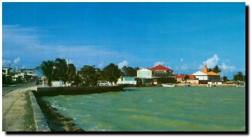
Corozal is Belize's northern most district. It borders Mexico and contains
the official northern border crossing at Santa Elena. The terrain is mostly swampy savanah but also contains highly developed agricultural areas. Its climate generally follows a pattern of tropical weather. Its rainfall is slighly lower than in the other districts.
Most of this agricultural development has been for the production of sugar cane. This product maintained the country's economy for many years after the demand for logwood fell in the early 1850's. Unfortunately, a fall in world demand for sugar in the 1970's resulted in a reccession for the farmers in this district who had converted even subsistence farms into sugar cane milpas. Corozal District is mostly spanish speaking. Its residents are the descendants of Maya Indians and Mexican Mestizos. Originally they farmed small plots of land for maize and other subsistence crops. Corozal hosts a wide variety of sights including several beach locations on the bay and many inland lagoons. It has several Mayan sites including Santa Rita and Cerros. Tours can be arranged through most travel agents. Major Town: Corozal Town Land Area: 718 Sq. Miles 


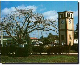
 You can get to Corozal Town by plane or road. Tropic Air has scheduled flights usually cost about US$109 roundtrip. However, a charter flight can be arranged with any of the local airlines. Buses leave on the hour and take about 2 - 3 hours. |